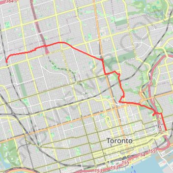
Kay Beltline - Rosedale Valley - Don Valley - Prohibition
Interactive map
GPS track profile
About this GPS track
Name: Kay Beltline - Rosedale Valley - Don Valley - Prohibition GPS track, route, trail
Coordinates: 43.65880 -79.46535 43.70476 -79.34983
Other GPS tracks
Click on a GPS track to view route, its statistics and profile.
Toronto Cycling
Distance: 39.0 Km • Elevation gain: 356 m • Maximum elevation: 124 m
Toronto - Oshawa
Canada > Ontario > Old Toronto
#Bike
Distance: 67.3 Km • Elevation gain: 457 m • Maximum elevation: 183 m
Brampton - Scarborough
Canada > Ontario > Peel Region > Brampton
Lake Ontario. #Bike #Brampton #Scarborough #Toronto #Ontario
Distance: 73.2 Km • Elevation gain: 570 m • Maximum elevation: 184 m