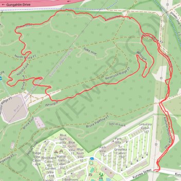
Bruce Ridge Nature Reserve
#Hike #Loop #BruceRidge
- Distance: 3.0 Km
- Elevation gain: 53 m
- Maximum elevation: 658 m
- Elevation loss: 53 m
- Minimum elevation: 604 m
- Moving time: 1 h 5 m
- Moving speed: 2.7 Km/h
- Maximum speed: 4.7 Km/h
- Total time: 1 h 13 m
- Global speed: 2.4 Km/h
- Date: 22/01/2020
Interactive map
GPS track profile
About this GPS track
Name: Bruce Ridge Nature Reserve GPS track, route, trail
Coordinates: -35.25728 149.10195 -35.25231 149.10824
Other GPS tracks
Click on a GPS track to view route, its statistics and profile.
Cloudride24.FINAL
Distance: 1,028.8 Km • Elevation gain: 21,282 m • Maximum elevation: 1,754 m