Import a GPX file

Chinese Montain

Randonnée en boucle depuis Heriot Bay. #Randonnée #Boucle

  • Distance: 4.5 Km
  • Elevation gain: 317 m
  • Maximum elevation: 320 m
  • Elevation loss: 313 m
  • Minimum elevation: 129 m
  • Moving time: 1 h 45 m
  • Moving speed: 2.6 Km/h
  • Maximum speed: 8.5 Km/h
  • Total time: 2 h 30 m
  • Global speed: 1.8 Km/h
  • Date: 08/03/2012

Interactive map

GPS track profile

About this GPS track
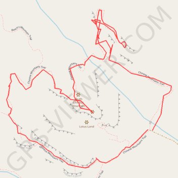
Other GPS tracks

Click on a GPS track to view route, its statistics and profile.

Campbell River - Sayward

Canada > British Columbia > Strathcona Regional District > Campbell River

Vancouver Island. #Bike #Campbell #Sayward #Vancouver

Distance: 61.9 Km • Elevation gain: 821 m • Maximum elevation: 312 m

Morte Lake, Quadra Island

Canada > Colombie-Britannique > Strathcona Regional District > Area B (Discovery Islands/Mainland Inlets)

Randonnée en boucle depuis Heriot Bay. #Randonnée #Boucle

Distance: 9.6 Km • Elevation gain: 352 m • Maximum elevation: 159 m