Awa'awapuhi Trail (Kauai Island)
Hike on Awa'awapuhi Trail in the Na Pali-Kona Forest Reserve. #Hike #Mountain #Volcano #Forest #Nature #Sea #Pacific #Ocean #Hawaii #Island
- Distance: 10.2 Km
- Elevation gain: 591 m
- Maximum elevation: 1,248 m
- Elevation loss: 590 m
- Minimum elevation: 702 m
- Moving time: 3 h 9 m
- Moving speed: 3.2 Km/h
- Maximum speed: 37.0 Km/h
- Total time: 3 h 41 m
- Global speed: 2.8 Km/h
- Date: 15/12/2017
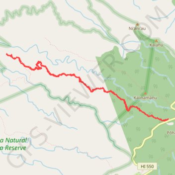
Interactive map
GPS track profile
About this GPS track
Name: Awa'awapuhi Trail (Kauai Island) GPS track, route, trail
Start: Awa'awapuhi Trailhead, Awa'awapuhi Trail, Kauaʻi County, Hawaii, United States (22.14152 -159.64866)
End: Awa'awapuhi Trail, Kauaʻi County, Hawaii, United States (22.14136 -159.64886)
Coordinates: 22.14113 -159.68143 22.15367 -159.64866
Other GPS tracks
Click on a GPS track to view route, its statistics and profile.
Lolo Vista and Nu'alolo Cliffs Loop (Kaua'i Island)
United States > Hawaii > Kauaʻi County
Loop hike to Lolo Vista and Nu'alolo Cliffs via Nu'alolo Trail, Nu'alolo Cliffs Trail, Awa'awapuhi Trail and Koke'e Road in the Koke'e State Park, Ku'ia Natural Area Reserve and Na Pali-Kona Forest Reserve. #Hike #Loop #Mountain #Volcano #Nature #Forest #Cliffs #Ocean #Sea #Pacific #Island #Hawaii #Island
Distance: 18.8 Km • Elevation gain: 965 m • Maximum elevation: 1,249 m
Pu'u O Kila Lookout to Koke'e Campground (Kauai Island)
United States > Hawaii > Kauaʻi County
Hike from Pu'u O Kila Lookout to Koke'e Campground via Pihea Trail, Kawaikoi, camp 10 Road, Alaka'i Picnic Area, Mohihi Road, Pu'u Ka'ohelo-Berry Flat Trail, Water Tank Trail and Pau Kaohela in the Koke'e State Park. #Hike #Mountain #Volcano #Nature #Forest #Park #Hawaii
Distance: 14.4 Km • Elevation gain: 423 m • Maximum elevation: 1,262 m