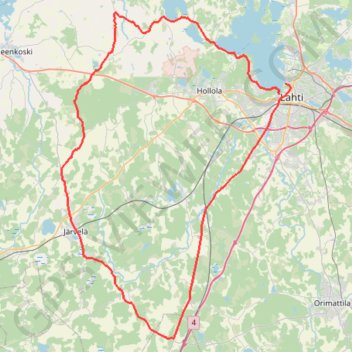
70.3_WC_2023_LahtiBikeA
- Distance: 89.7 Km
- Elevation gain: 796 m
- Maximum elevation: 161 m
- Elevation loss: 783 m
- Minimum elevation: 76 m
Interactive map
GPS track profile
About this GPS track
Name: 70.3_WC_2023_LahtiBikeA GPS track, route, trail
Coordinates: 60.77390 25.25235 61.05482 25.65989
Other GPS tracks
Click on a GPS track to view route, its statistics and profile.
Stage 1: Arctic Ocean to Väylä — European Divide Trail
Distance: 2,785.0 Km • Elevation gain: 23,823 m • Maximum elevation: 722 m