Valle delle Ferriere
- Distance: 9.8 Km
- Elevation gain: 735 m
- Maximum elevation: 482 m
- Elevation loss: 760 m
- Minimum elevation: 23 m
Interactive map
GPS track profile
About this GPS track
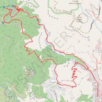
Name: Valle delle Ferriere GPS track, route, trail
Start: Via delle Cartiere, Pogerola, Amalfi, Salerno, Campanie, 84011, Italie (40.63984 14.59947)
Coordinates: 40.63499 14.57971 40.65141 14.60218
Other GPS tracks
Click on a GPS track to view route, its statistics and profile.
Percorso selezionato
Italie > Lombardie > Côme > Côme
Percorso calcolato con http://www.bicitalia.org/it/routing-gpx
Distance: 1,543.9 Km • Elevation gain: 17,951 m • Maximum elevation: 1,034 m
Valle delle Ferriere
Italy > Campania > Salerno > Pogerola
Distance: 9.8 Km • Elevation gain: 735 m • Maximum elevation: 482 m