Nicolas_Vanvyve_2021-09-01
- Distance: 20.3 Km
- Elevation gain: 31 m
- Maximum elevation: 115 m
- Elevation loss: 23 m
- Minimum elevation: 93 m
- Moving time: 4 h 41 m
- Moving speed: 4.3 Km/h
- Maximum speed: 9.4 Km/h
- Total time: 6 h 6 m
- Global speed: 3.3 Km/h
- Date: 01/09/2021
Interactive map
GPS track profile
About this GPS track
Name: Nicolas_Vanvyve_2021-09-01 GPS track, route, trail
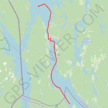
Start: Spargott, Bengtsfors kommun, Comté de Västra Götaland, Suède (59.22578 11.95812)
End: Årjängs kommun, Comté de Värmland, Suède (59.36356 11.87011)
Coordinates: 59.22574 11.87003 59.36663 11.95812
Other GPS tracks
Click on a GPS track to view route, its statistics and profile.
Stage 1: Arctic Ocean to Väylä — European Divide Trail
Distance: 2,785.0 Km • Elevation gain: 23,823 m • Maximum elevation: 722 m
Nicolas_Vanvyve_2021-08-29_11-38-26
Distance: 15.0 Km • Elevation gain: 41 m • Maximum elevation: 107 m
Nicolas_Vanvyve_2021-08-31
Distance: 19.0 Km • Elevation gain: 48 m • Maximum elevation: 120 m